


N5 GNSS Receiver
N5 GNSS Receiver
Description
Embedded with IMU engine, upgraded with K8-platform for full constellation tracking, and equipped with long range enhanced UHF, user-friendly OLED display, 6800mAh large Li-battery, N5 GNSS receiver provides a more convenient, reliable, and efficient experience for field workers, especially when work together with Survey Master data collection software.
Features
- Full-constellation & full frequency tracking
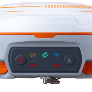
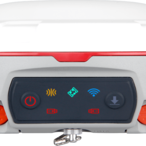
- User-friendly OLED Display
- 6800mAh Large Li-battery for over 24 hrs working time
- Enhanced UHF for up to 15km working range
- Rugged housing
- Web-based UI
- Up to 60° tilt surveying
- Seamlessly Work with Network RTK Positioning
Additional information
| Weight | 1.2 kg |
|---|---|
| Dimensions | 15.5 × 7.3 cm |
| Signal Tracking | 1198 channels for simultaneously tracking satellite signals, GPS – L1C/A, L2C, L2P, L5, BeiDou – B1I, B2I, B3I, B1C, B2a, B2b, GLONASS – L1, L2, Galileo – E1, E5a, E5b, E6, AltBOC, QZSS- L1C/A, L1C, L2C, L5, Navic – L5, SBAS – WAAS, EGNOS, MSAS, GAGAN, SDCM, BDSBAS |
| Data Format | Correction data I/O – RTCM 2.X, 3.X, CMR (GPS only), CMR+ (GPS only), Position data output – ASCII: NMEA-0183 GSV, RMC, HDT, VHD, GGA, GSA, ZDA, VTG, GST; PTNL, PJK; PTNL, AVR; PTNL, GGK, ComNav Binary update to 20 Hz |
| Performance Specifications | Cold start – <50 s, Warm start – <30 s, Hot start – <15 s, Initialization time – <10 s, Singal re-acquisition – <1.5 s, Initialization reliability – >99.9% |
| Environmental | Operating temperature – -40 °C to + 65 °C (-40 °F to 149 °F), Storage temperature – -40 °C to + 85 °C (-40 °F to 185 °F), Humidity – 100% non-condensing, Waterproof and dustproof – IP67 protected from temporary immersion to depth of 1 m, Shock – Designed to survive a 2 m drop onto concrete |
| Electrical and Memory | Input voltage – 7-28 VDC, Power consumption – 1.7 W, Li-ion battery capacity – 2 × 3400 mAh, up to 25 hours typically, Memory – 8 GB |
| Positioning Specifications | Static and Fast Static – 2.5 mm + 0.5 ppm Horizontal 5 mm + 0.5 ppm Vertical, Long Observations Static – 3 mm + 0.1 ppm Horizontal 3.5 mm + 0.4 ppm Vertical, Real Time Kinematic – 8 mm + 1 ppm Horizontal 15 mm + 1 ppm Vertical, DGPS – <0.4 m RMS, SBAS – 1 m 3D RMS, Standalone – 1.5 m 3D RMS, PPP – 10cm Horizontal and |
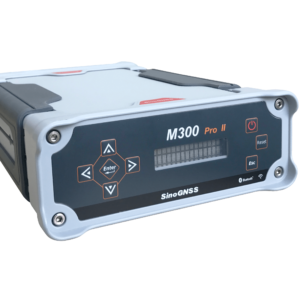
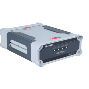
| Communications | 1 Serial port (7 pin Lemo), Baud rates up to 921,600 bps, Enhanced UHF modem – Tx/Rx with full frequency range from 410-470 MHz, Transmit power – 0.5-2 W adjustable, Range – 15 km, WIFI/4G modem, LTE-FDD – B1/B2/B3/B4/B5/B7/B8/B12/B13/B18/B19/B20/B25/B26/B28, LTE-TDD – B38/B39/B40/B41, WCDMA – B1/B2/B4/B5/B6/B8/B19, GSM – B2/B3/B5/B8, Position data output rates – 1 Hz, 2 Hz, 5 Hz, 10 Hz, 20 Hz, 2 LEDs (indicating Satellites Tracking and RTK Corrections data), 1 OLED Display and 2 Function buttons, Bluetooth® – V 4.0 protocol, compatible with Windows OS and Android OS, Calibration-free IMU integrated for Tilt Survey, Up to 60°tilt with 2.5 cm accuracy |
| Software | Survey Master Android-based data collection software, Carlson SurvCE field data collection software (optional), MicroSurvey FieldGenius field data collection software (optional) |
Reviews
There are no reviews yet.